History of Barford near Warwick
Barford is a historic village located approximately three miles south of Warwick in Warwickshire, England, situated along the banks of the River Avon. The village’s history spans over a millennium, from its prehistoric origins through its development into a modern commuter community.
Ancient Origins and Anglo-Saxon Settlement
Archaeological evidence suggests human activity in the Barford area dates back to prehistoric times. Two to three miles below Barford, between Wasperton and Charlecote, long barrows and mortuary enclosures have been excavated, and at Longbridge, cursus and henges have been found. According to architectural historian Nikolaus Pevsner, “the largest cursus in the country is that at Longbridge Farm, Warwick, which is visible from the air, for some 900 feet, and an apparent long mortuary enclosure, attached to the end of a cursus occurs at Barford”.
The first substantial settlement in Barford was likely Anglo-Saxon, established during the Migration period (410-800 AD). The Anglo-Saxons first entered Warwickshire through the river valleys, and Barford was probably settled by the group known as the Hwicce. Archaeological excavations prior to the construction of the Barford Bypass revealed a sunken-feature building (grubenhaus) dating to this period, located adjacent to the edge of the river terrace.
Medieval Period: The Birth of “Bereforde”
The Domesday Survey and Norman Conquest
Barford appears in the Domesday Book of 1086 as “Bereforde,” making it one of the earliest documented references to the settlement. The name derives from the Old English meaning “a ford which can carry a load of corn,” referring to the shallow crossing of the River Avon that gave the village its strategic importance.
The Domesday entry records that the Saxon lord “Saewulf” held the land before 1066, consisting of 5 hides. After the Norman Conquest, the area was divided between Hugh Osbern (holding 4 hides) and William Corbucion (holding 1 hide). The survey also mentions a watermill valued at “2 shillings and 13 sticks of eels” (a stick being 25 eels).
Medieval Church and Religious Life
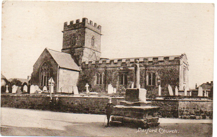
St Peter’s Church has been a site of Christian worship for over 1,000 years, with a resident priest recorded in the Domesday Survey of 1085. The Saxon church was rebuilt at the beginning of the 13th century, possibly by the same masons who worked on Warwick Castle and St Mary’s chancel.
A significant religious presence was established early in the 13th century when Trinitarian Friars of Thelsford were based at a monastic farm or grange opposite the church in Barford. These friars, recognizable by their white robes with blue and red crosses, cultivated fertile land stretching down to the river and operated under vows to divide their possessions into three parts: one for sustenance, one for the poor, and one to redeem Christians held captive by infidels.
Lords of the Manor
The manor of Barford passed through several noble hands over the centuries. The Verdon family held the manor from 1212 until 1385, followed by the Lords Willoughby de Broke and the Earls of Warwick. This feudal system significantly influenced village development and social structure.
Tudor and Stuart Periods
Civil War Impact
During the English Civil War, Barford found itself caught in the conflict. The church tower bears shot marks said to have been made by Parliamentary soldiers marching toward Kineton before the Battle of Edgehill in 1642. According to local tradition, a member of the Warde family hoisted the Royal Standard on the church flagpole, and the Roundheads attempted to shoot it down.
The Water Mill
The village’s medieval water mill continued to be economically important throughout this period. Documentary evidence shows intermittent records of milling from the Domesday survey through to the Imperial period. By the 13th century, there appear to have been three mills operating in Barford.
18th and 19th Century Transformation
The Enclosure Act of 1761
A pivotal moment in Barford’s history came with the Enclosure Act of 1761, which transformed the medieval landscape. Until the 18th century, the area had been dominated by the medieval open field system with characteristic ridge and furrow patterns. The Act united scattered strips into large compact fields, creating the modern agricultural landscape.
This transformation had profound social consequences. Instead of working their own land, most men became agricultural workers employed by landlords. Allotments were first created at this time to compensate “peasants” deprived of their land.
Industrial Developments
The 18th and 19th centuries saw significant modernization in Barford:
Barford Gas Works was established in 1872, consisting of one gasholder and three retorts. It provided gas for domestic lighting and heating until closing in 1920.
The village had two forges – one by the river and another on High Street. The High Street forge closed in 1978 and was converted into a private house.
A school was built in 1851 by the National Society, replacing earlier educational provisions dating back to 1677.
Joseph Arch: National Figure
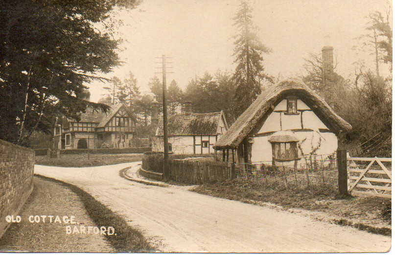
Barford’s most famous resident was Joseph Arch (1826-1919), founder of the National Agricultural Labourers’ Union and later Member of Parliament. Born in a cottage that still stands in the village, Arch founded the union following a meeting under an oak tree in nearby Wellesbourne on February 7, 1872. The union grew to 86,000 members at its peak in 1874 and played a crucial role in securing voting rights for agricultural workers in the Reform Act of 1884-85.
Modern Development
20th Century Changes
The 20th century brought significant changes to Barford’s character:
The water mill was demolished in the 1930s as part of flood prevention measures
New housing developments occurred in phases: 1930s (Mill Lane), 1950s (Sandy Way, Wasperton Lane), 1960s (Dugard Place, Keytes Lane, Fairfax Close), and 1970s (Carter Drive)
Council housing was built beyond Wasperton Lane after World War II as some old cottages were deemed unfit for habitation
The M40 Impact
The construction of the M40 motorway in the late 20th century significantly impacted the village. The motorway section between junctions 8 and 9, which passes near Barford, was completed in January 1991. Construction began at Warwick in October 1987, fundamentally altering the village’s relationship with the surrounding landscape.
Contemporary Barford
Today, Barford has evolved from a largely self-sufficient agricultural community into a commuter village. Few residents now work within the village itself, and the community is held together by church activities, various leisure societies, and local organizations like the Barford Heritage Group.
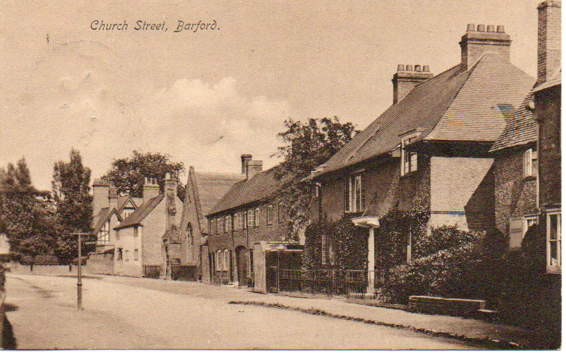
The village retains much of its historic character, with numerous 17th-century timber-framed houses and the medieval church tower still dominating the skyline. The River Avon continues to be spanned by a stone bridge, rebuilt in the late 1700s but first mentioned in 1484.
Barford’s history reflects the broader transformation of rural England – from Anglo-Saxon settlement through medieval manorialism, agricultural revolution, and industrial development to modern suburbanization. Despite these changes, the village maintains its connection to over a thousand years of continuous habitation along this strategic crossing of the River Avon